BY KEVIN DUGGAN
North Brooklyn environmentalists
and Pratt Institute
have created a map charting
historic environmental pollution
in Greenpoint, Williamsburg,
and adjacent neighborhoods.
The local nonprofi t North
Brooklyn Neighbors, together
with the academics, launched
the map as part of their Environmental
Legacy and Improvements
project back in
May. Their goal, according
to the head of the group, is to
help residents at the borough’s
northern end know what toxic
materials are buried beneath
them, how they got there, and
make it easier for them to organize
and advocate for a cleaner
nabe.
“The environmental concerns
can be very daunting
and scary and the map can provide
information on how these
things got there and how the
neighborhood has worked on
these things for a long time,”
said Anthony Buissereth, executive
director of North Brooklyn
Neighbors. “Our goal is
that folks feel empowered and
not scared.”
The organization has
worked with Pratt Institute’s
Spatial Analysis and Visualization
COURIER L 6 IFE, SEPT. 25-OCT. 1, 2020
Initiative since 2018 to
pull the often complex and obscure
environmental data from
various city, state, and federal
agencies and layer it onto a map
of the area with simple background
explanations of each
polluted site.
Scrolling through the ELI
site, text, images, and old maps
lay out the history of north
Brooklyn and its changing
uses — from being the ancestral
land of the Keskachauge
people, a subtribe of the Lenni
Lenape, through to its industrial
heyday in the 19th and
20th centuries, and the development
of glittering residential
towers replacing low-rise manufacturing
buildings along its
waterfront at the dawn of the
21st century.
The area’s heavy industry
caused a lot of today’s toxic pollution,
such as the Greenpoint
oil spill where some 17 to 30 million
gallons of oil leaked from
local refi neries into the soil and
fl owed into Newtown Creek for
decades until offi cials discovered
it in 1978.
Another more recent example
is 34 Berry St., where the
owner of a luxury apartment
complex applied for the state’s
Brownfi eld Cleanup Program
to remediate toxic soil years after
building residences on top
of it.
Many of the cleanup programs
in the area are either
a precursor to or as a result of
new real estate development.
Buissereth, of North Brooklyn
Neighbors, said that the extent
of contamination remains less
explored in other areas as a result,
such as below Meeker Avenue
in Greenpoint and East Williamsburg,
where DEC found
several plumes of toxic chemicals
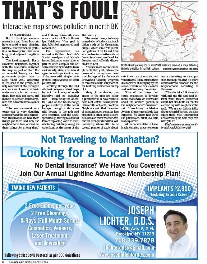
North Brooklyn Neighbors and Pratt Institute created a map detailing
historic pollution in north Brooklyn. Screenshot/North Brooklyn Neighbors
known as chlorinated solvents
in 2007 likely buried there
due to years of dumping by the
area’s industrial dry cleaners
and metalworking companies.
“One of the things that
spurs exploration is development,
that’s why we know a lot
about the western portion of
the neighborhood,” Buissereth
said. “I would say the Meeker
Avenue plumes are a little less
explored. We know how large
the plumes are, but it is a little
less explored.”
At the bottom of the ELI site,
locals can also report concerning
or interesting fi nds and pin
it on the map, making it a more
crowdsourced database for the
neighborhood, according to
Buissereth.
“The idea is for folks to work
with and use the data and inform
what they’re concerned
about, but also build on that by
connecting with neighbors,” he
said. “We try to inform folks
about potential harms, but also
equip them with information
and advocacy on how they can
navigate it.”
Find out more at www.northbrooklynneighbors.
org/eli.
THAT’S FOUL!
Interactive map shows pollution in north BK